The Best Time to See Minnesota’s Fall Colors
Fall is here and the air is getting cool. Time to put away the flip flops and pull out the sweatshirts. And soon, it will be time to take in the splendor of nature as the leaves change from green to a vivid array of yellow, orange and red. But, knowing exactly when the best time to get out and see the colors can be tricky. Lucky for you, we've got it covered!
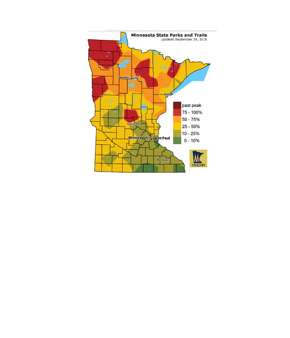
The Minnesota Department of Natural Resources creates a fall color finder each year. It's updated regularly and uses a color code system to show where in the state of Minnesota the colors are at their most vibrant. The scale includes six colors showing various degrees of fall color ranging from 0-10 percent to past peak so that you can plan when and where to take a fall ride, stroll or pedal. Right now, the northwestern part of the state, as well as a couple of other small portions are at 75-100 percent color. The southeast portion is at 10-25 percent. Check back to the site regularly to track where the fall colors are at their peak.
Please note that the map below is a stagnant image, and to get the current map, you should check the Minnesota Department of Natural Resources webpage.

More From KRFO-FM